GIS for Conservation
The field of conservation biology was developed to bridge traditional ecology and the practical issues of species and habitat. The discipline of conservation biology encompasses social sciences, wildlife management, population dynamics, genetics, and analysis of biodiversity. With nature knowing no boundaries in such a heterogeneous landscape, understanding species ecology gets quite challenging. This is where GIS comes in.
GIS stands for Geographic Information Systems (or GIScience for the more daring), and was first introduced in 1960’s as a tool for storing, visualizing, and analyzing spatial data. Nowadays, GIS is recognized as its own discipline and is present every day of our lives, starting with our phones to watching the weather forecast. If you see any modern map, you can bet it was elaborated by a GIS professional on a GIS software. This spatial revolution also came with an enormous expansion of data collection capacity – the Big Data phenomenon-, thanks to satellites and users. Accordingly, these advances have had a sizable impact on ecology and conservation, allowing scientists to statistically analyze, visualize, and scale their perception of landscapes and species within a landscape at an extent that would have been previously unthinkable.
The applications of GIS on fisheries and wildlife science are diverse, and we couldn’t get a hold on it in 300 words, but here you can see some example of applications in our research and others research.
Examples of Using GIS
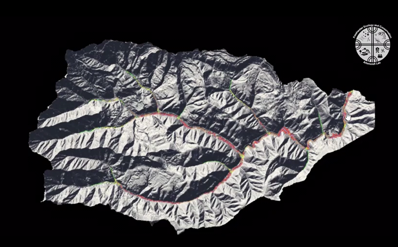
3D Representation of a Watershed in Western Oregon (using GIS!): This watershed holds one of the healthiest populations of Coho Salmon in the contiguous U.S. Using geoprocessing algorithms and high-resolution elevation, Andres Olivos was able to study salmon-habitat characteristics such as channel gradient, flow, and floodplain interactions, which are believed to influence population dynamics in freshwater systems.
Check out these Sources
Technology, training, and support by ESRI : HERE
Conservation Training, focus on GIS online training: HERE
MapX, mapping and monitoring of natural resources: HERE
Movebank, free, online database of animal tracking data: HERE
GBIF, open access data about all types of life on Earth: HERE